My Holiday
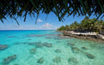
May 2016 This trip started with the flight to Mexico City. After a 3 and a half hour stop I flew to my final destination Los Cabos. I stayed for four night at the Tesoro los Cabos in Cabo San Lucas about a 40 minutes drive from the airport. Eight o'clock, the 21st, I embarked the ship Nautilus Belle Amie. After a one-day ocean crossing I arrived at the Revillagigedo islands. It's a group of four vulcanic islands; San Benedicto, Socorro, Roca Partida and Clarion. Here we dived for 5 days with interaction with dolphins, hamerhead and silky sharks, possible whale sharks and the great Manta's. After the diving days we went back to Cabo San Lucas and stayed on board for one more night.Location
Revillagigedo islands lies approximately 390 kilometres (240 mi) southwest of Cabo San Lucas, the southern tip of the Baja California Peninsula. They are located around 18°49′N 112°46′WCoordinates: 18°49′N 112°46′W. The islands have been part of Manzanillo municipality of the Mexican state of Colima since 1861, but are nevertheless under Mexican federal jurisdiction.
Geography
The total area is 157.81 km2 (60.93 mi2), spread over an east-to-west extent of about 420 km (261 mi). The islands are uninhabited. The islands are named after Don Juan Vicente de Güemes, 2nd Count of Revillagigedo, the 53rd viceroy of New Spain. The three eastern islands are called the inner islands and are: San Benedicto, Socorro (San Tomás) and Roca Partida. 200 km west lies the fourth island Clarión (Santa Rosa).Language
Spanish is the main language.Climate
The regional climate is considered arid or desertic, with an average yearly temperature higher than 22ºC. Climate is regulated by tropical depressions and hurricanes that occur during the summer and which characterize the Western Pacific. Annual rainfall is scarce (313 mm) and takes places mainly during the months of August to October, with a predominant regime of summer rains.The average temperature of the islands´ surrounding waters fluctuates between 28ºC and 29ºC during the summer, while during the winter the average surface temperature of the adjacent oceanic water oscillates between 22ºC and 25ºC.
Diving conditions
Visibility, which on average is very good, varies from time to time and place to place. Wind, rain, current and tide can all play their part is affecting visibility. Sometimes in November and December the visibility can drop from the average of 30m to around 15-20m, although this tends to be only at a few dive sites. Being open ocean islands, surface conditions at Socorro are variable. There are often quite sheltered mooring spots around the islands but the seas can be choppy during crossings.
Time difference
-06hrs GMT